Saturday, July 4, 2015

St Pierre & Miquelon

WHAT, WHERE?
Lily, Sebastian and I ventured to Saint Pierre and Miquelon, a self-governing overseas collectivity of France in the northwest Atlantic near Canada to seek out the last outpost of French colonialism in the region. The tiny islands of St Pierre & Miquelon (pronounced 'meek-lon) are nestled about 30km from the southern shore of Newfoundland and 3,700km west of European France. No doubt about it, this place is French. They fly the tricolor, spend the Euro, eat baguettes for breakfast, drive badly, make great coffee, close for lunch, drink wonderful wine and walk their poodles while smoking Gauloises. This is France. In North America.
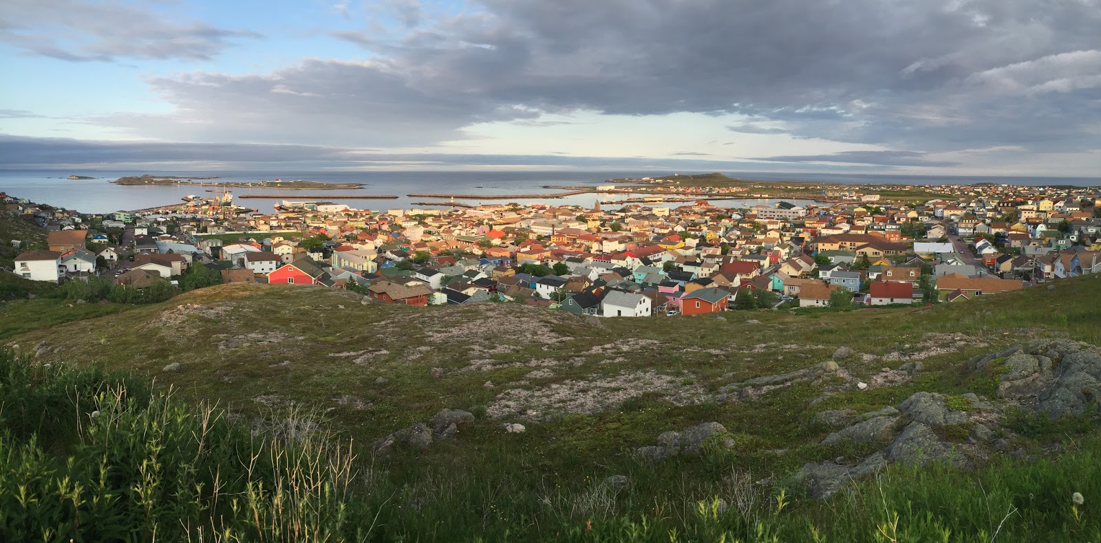
The town of St Pierre from the lookout
GETTING HERE
We flew from Dallas to Boston then drove for the best part of two days through Massachusetts, New Hampshire, Maine, New Brunswick and Nova Scotia to the airport at Sydney for our flight to St Pierre. We were early for the flight and because we were the only passengers, the flight left an hour early. Our pilot, 21 year Dominic, had just received his pilots license in the mail and was excited to be taking his first paying passengers across the Gulf of St Lawrence to the tiny St Pierre airstrip. On learning this, I was not so excited.

Boarding Air St Pierre

St Pierre from the plane
The airport in St Pierre is less than 20 years old and because we were on the ONLY flight of the day we passed through immigration and customs in record time. In fact there was no customs. And the immigration officer left the airport for the day as soon as he finished stamping our passports. He was quickly followed by the pilot. The only unfortunate part was that because we were early, the taxi I had arranged with the hotel wasn't at the airport yet. We were the only ones there. After a quick phone call and a short wait we were at the brand new Hotel Jacques Cartier and it was fabulous - massive rooms and close to absolutely everything.

SOME FACTS
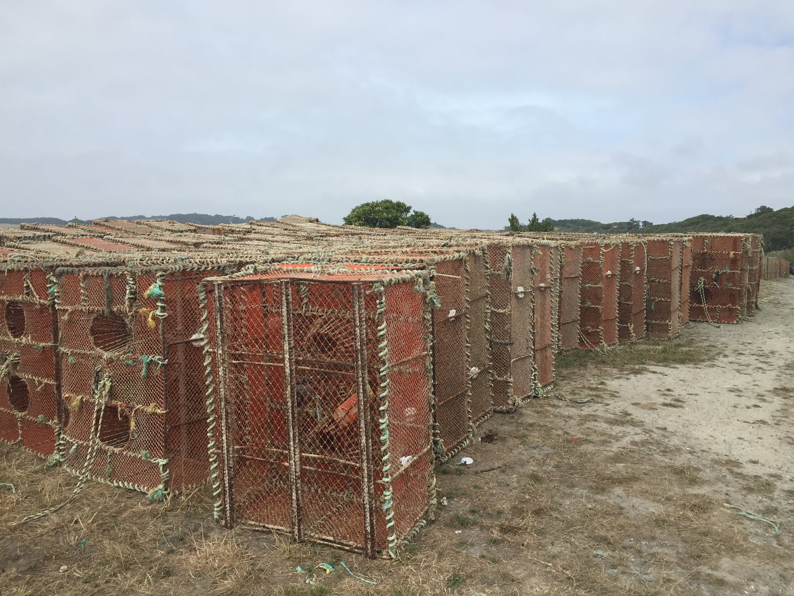
About 7,000 people live on the islands of Saint Pierre and Miquelon, but there are almost 5,000 cars and barely 100km of roads. Almost everything is imported from either France or Canada, and the modest exports all come from the sea - fish, mollusks and crustaceans. There have been over 600 shipwrecks since 1800. Even at the height of summer it was cold and wet every day we were there.


EXPLORING ST PIERRE
A couple of days were spent wandering the streets of St Pierre and taking in the local highlights - the waterfront area, the lighthouse, cathedral, lookout point, and the many interesting houses. We ate at numerous cafes but the ones that stood out were Le Feu de Braise which had the best steak frites, Cafe du Chat Luthier just around the corner from the hotel and Les Delices de Josephine which had some of the best pastries around. The kids tried all of the ice cream shops and we all enjoyed the fresh bread everyday.

The waterfront and lighthouse

The Zazpiak Bat court
Just behind the cathedral is a place called Fronton Zazpiak Bat - which is a big red wall with one court on each side for a game called Jai-Alai. I didn't see any games being played but basically two people take turns at hurling a ball against the wall with a big scoop, trying to get it past the other. It's supposed to be one of the fastest sports in the world and is very popular in the Basque region of Spain. It looked impressive because the wall is huge, bright red and stands out like a beacon.

EXPLORING MIQUELON

At the tourist office in the town square we booked a day trip to Miquelon. We chronically underestimated how cold and windy it was going to be but our tour guide was kind enough to stop at her house and get some warm clothes for the kids to wear during the trip. The ferry was pretty rough and Seb vomited on the way over but once we got to Langlade all was well.
The zodiak with the main boat in the background

The drive from Langlade to the town Miquelon took us along the narrow isthmus and around the western coast to the very north of the island. The town is unremarkable but the church is pretty and the boats make for some very picturesque photos. There's a neat little museum with lots of nautical artifacts showcasing the unique history of the islands.

The church in Miquelon
There is a grave in the local cemetery for a British sailor - I forget his name. Legend has it that when you stand on his grave, you are actually standing in England. So the kids took turns jumping on and off the poor sailors grave because they really wanted to go to England.

Central Miquelon
I was quietly impressed with Saint Pierre and Miquelon - the food was fantastic and being 'in France' made it feel European somehow. But even in summer the weather was awful and everything is very expensive. I'll probably never go back, but I'm glad I've been.

Monday, March 2, 2015

Chatham Islands, New Zealand

TUESDAYS WITH BARRY

For something a little different, yet vaguely familiar, my Dad and I decided to take a short trip to New Zealand's eastern outpost, the remote Chatham Islands with a population of barely 600. The Chatham's have officially been part of New Zealand since 1842 and include the country's eastern most point, the beautifully named Forty-Fours, but if you ask any Chatham Islander they'll tell you this isn't New Zealand. And to make the point, this is the only place on earth to observe Chatham Standard Time Zone -  confusingly forty-five minutes ahead of New Zealand.

Flights to the islands on Air Chathams (in a Convair 580) depart from Auckland, Christchurch or in our case Wellington. The scarcity of flights mean passengers and freight share the main cabin. The first 15 or so rows of our flight were taken up with all sorts of household goods covered in blue plastic wrap. After a brief delay the flight took off and about an hour and a half later we landed at remote Tuuta airport next to a large lagoon far away from any sign of civilization. There's no public transport on the island so it's essential to have accommodation booked in advance. Dad arranged a rental car at the airport - an old Honda CRV with the keys permanently stuck in the ignition. We found the proprietor of the Hotel Chathams, who also doubled as the rental car agent, and followed her, via a quick stop to take in the views or Petre Bay, to the Chatham Rise annex, a few hundred meters from the main hotel in the capital city, Waitangi (population 200).

Petre Bay looking towards Waitangi
Hotel Chatham is pretty much the only game in town. The only pub, the only restaurant, the only hotel, the Air Chathams air hostess doubles as the bartender and the fish and chips is a bargain at $25 a plate.  After dinner we took a drive along Port Hutt Road to the tiny village of Port Hutt, stopping at the Basalt Columns at Ohira Bay along the way. The hexagonal columns are similar to the Giants Causeway in Ireland but much smaller (so I'm told since I haven't been to Giants Causeway). The funny thing about getting there was that the bay is on private land so we had to get permission, and a key to unlock the gate, to access the farmland the columns are next to. The directions went something like; drive through the gate, turn right at the picnic table, avoid the sheep, over the rise and down to the park bench. We arrived not  long before sunset and had the place to ourselves. The only two tourists at Ohira Bay that evening.

Hotel Chathams, our Honda CRV and Dad
The Basalt Columns at Ohira Bay
The next day we joined a tour group and left the rental car in Waitangi for the morning and headed to the south eastern coast along the Waitangi Tuku Road past beautiful coastline and stunning farmland. On the way back we encountered a New Zealand traffic jam as a farmer herded a flock of sheep along the main road between two paddocks. Back with our own car in the afternoon we followed the tour group to the Ocean Mail Scenic Reserve, the town of Kaingaroa, the seal colony at Port Munning (again only accessible only through private farm land), and the remains of the Sunderland flying boat in an old farm shed (on the same farm).
The loading ramp at Kaingaroa

Dad and I at Port Munning
Crayfish pots - Kaingaroa
We left the tour group late in the afternoon and drove to the south eastern coast in search of the best views of Pitt Island. It was another case of following hilarious directions; turn off the main road at the fish factory, through the gates, follow the fence line, past the cattle, over the ridge to the cliffs of Manukau Point. The cliffs are amazing and the views stunning and once again we were the only people for miles around. It was incredibly serine and the great weather meant we could easily make out Pitt island in the distance of the south coast.

The southern coast of Manukau Point, near Owenga
The last stop of the day was the statue of the Chathams most famous son. Tommy Solomon was the last full-blooded indigenous Chatham Islander, or Moriori. He was however, not the last Moriori. His own descendants and the descendants of other Moriori live on today. He died in 1993 but his statue, erected in 1985, sits on the property of his descendants, on the eastern corner of the island near Owenga, facing eastward and staring out across the Pacific. As with most places we visited during our two days, we were the only two people there, surrounded by Tommy's spirit.
Dad talking to the Tommy Solomon statue
Everyone we met said two days was not enough time and they were right. The trip was far too short but it was brilliant to be somewhere familiar, yet so different all at the same time. As the locals will tell you, this is not New Zealand.